
Efficacy test of the application of ADR technology to commercial coal exploration for coal layers and related pathfinder stratigraphy in Coal Mountain, Canada.
Project aims
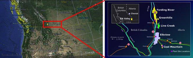
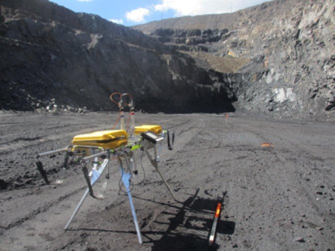
The objectives of the geophysical survey at Coal Mountain using ADR scanner methods were firstly, to determine the depth of the coal seam and map how it bends in the subsurface, and secondly, to locate the abandoned mine workings above the coal seam. The field survey was conducted in July 2013 by Adrok on behalf of Teck Resources Limited (“TRL”) in Coal Mountain, Canada. A total of twelve virtual borehole sites were scanned by Adrok.
Exploration/Project challenges
The project challenge was to check if ADR technology could find thin coal seams and old mine workings in depth.
Geological context
Coal Mountain is located 30 kilometres southeast of Sparwood in south-eastern British Columbia. The open-pit coal mine at Coal Mountain in the Elk Valley area is operated by Teck Coal Limited, which is the world’s second-largest exporter of metallurgical coal. The main product shipped from Coal Mountain mine is Pulverized Coal Injection (PCI) coal2.
The mine at Coal Mountain is part of the Crowsnest coalfield, which lies in the Fernie Basin, a broad north-trending synclinorium. The host rocks in the Crowsnest district are of the Jurassic Kootenay formation. The strata have been extensively folded and faulted helping in the increase of the apparent thickness of the seams in some areas.
Adrok’s result
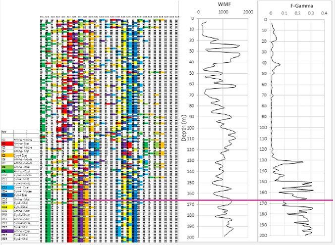
The coal seam has been identified in the subsurface using a combination of Adrok’s interpretation techniques, such as, rank matching, WMF and frequency harmonic log patterns.
Rank matching technique was used to identify coal in the subsurface through changes in the similarities of coal typecasting samples to geophysical results. WMF and frequency harmonic logs (F-gamma and F-ADR) provide clear evidence of lithological changes through variations in their responses. Where these responses are correlated, a coal seam can be identified at Coal Mountain across nine V-Bores (Figure 3). At site AD-1 and AD-2 the base of the coal seam is found to be at 150m depth. This dips eastwards towards the remaining sites up to a shallower depth of around 120m.
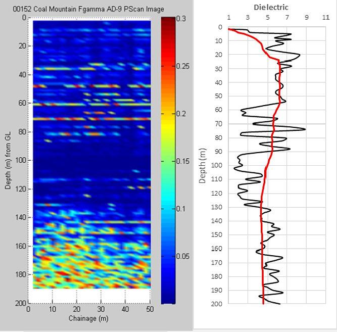
Mine workings at 63m depth can be identified on the basis of low dielectrics, high amplitudes on the P-Scan image, and high F-gamma responses (Figure 4). The lateral extent of these workings is shown on the P-scan image and suggests the workings are located between the survey points of 20m and 28m along the survey scan line.
Benefits to client
Adrok showed that coal layers can be identified and mapped in detail using a combination of the ADR interpretation tools (rank matching, WMF and frequency harmonic logs). Consequently, ADR technology can be used as an alternative to the conventional geophysical methods to identify coal layers in the subsurface quicker, cheaper, greener and in a non-destructive way.
